onsdag den 27. februar 2008

ESRI Emphasizes New Workflows through ArcGIS 9.3 Enhancements at Federal User's Conference


http://www.directionsmag.com/article.php?article_id=2698&trv=1

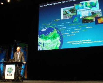
Opening Keynote
In greeting the attendees to ESRI's Federal User Conference (FedUC), ESRI President Jack Dangermond implored the audience to take a "new geographic approach," a theme he has emphasized over the past year. "Our world needs a new approach. We need to look at new ways to make the world work," he said. "Our carbon footprint is way over the line. [We need] to help make our communities more livable. And communicate more effectively, improve the way we live in our environment and mitigate conflicts." Dangermond believes that taking a geographic view of the world and the world's information is a holistic way to integrate a knowledge base. "In this first 40 years, GIS is starting to make a difference... GIS professionals working together can help this new approach."

ArcGIS Matures with Release of 9.3
ESRI representatives presented a list of enhancements for ArcGIS version 9.3 and noted in particular that this release has greatly improved documentation. Users can expect the release in April or May.

Some key enhancements include more refinement of iterative modeling and a new feature for a geographically weighted regression model. One demonstration included a foreclosure analysis - a hot topic in today's economic environment. An analyst explored where and why foreclosures occurred in 2007 using Department of Housing and Urban Development data. Spatial regression tools helped reveal the social and economic factors that led to the foreclosures. These tools can also be used to predict other areas at risk. The analysis revealed the combination of variables that significantly contributed to the foreclosures. For example, the debt ratio might be important in one geographic area, but unimportant in other geographic areas. Geographically weighted regression (GWR) creates focused equations that take into account the local parameters of the data. In the demonstration, GWR had an R2 value of 79.98% reliability, a number that represents a high correlation of factors. This index of the model's reliability provides a high confidence level, suggesting it's possible to predict areas that may be facing foreclosure, and perhaps address the problem before it is too late.

Other usability improvements in 9.3 include the following:

revamped management dialog box
new top menu location for Bookmark Manager
new Labeling function, including an option for "pausing" labels while the mouse button is depressed over the label to expose layers below the label
group layers and time series data (In the past, there were some challenges in turning on/off layers. A new keyboard shortcut allows the user to step through a time series using a menu pick.)
greater capability for graphic shapes, with a new option to attach information to a redlined shape without creating a shapefile (Graphics may be converted to the shapefile format with features in a separate function.)
match a legend feature color scheme with that shown on the map (The example given was a color ramp which could be altered in the map view by increasing the transparency, but the change was not always reflected in the legend. The new feature matches the legend with the map view more closely.)
advanced sorting option, in table views, to choose multiple fields and sort across those columns
field aliases, which allow the user to toggle between the internal database fields and the more useful aliases (With 9.3, aliases are persistent even after Joins.)
Joins - a new property set shows how the joins were created
Identify dialog box, creates a shortcut to the attribute table
symbology changes, including the ability to click on any feature on the map and get to the symbology in a pop-up dialog box
Disperse Markers that allow the user to change the cartographic representation of features on the map but not the underlying geographic reference
Send Crash Report (Huge applause erupted from the audience when the "Send Crash Report" dialog box popped up after John Calkins intentionally crashed the program. The feature sends bug reports directly to ESRI.)

ArcGIS Server Platform
ArcGIS Server 9.3 enhancements include the following on the Server and User Tiers:
Server Tier

better integrated and improved imagery management (Image server had been a separate service in 9.2. The approach now is to take imagery and plug it into the server and then serve it out to an application. Image processing steps are done on the server. The idea is to acquire raw imagery in a block and serve it out on demand. Image Service is a very fast raw imagery service that supports multispectral imagery. ArcGIS Server becomes an image service to image processing clients like ITT's ENVI.)
support for Role based user security
interoperability standards maintained
geodatabase enhancements, including support for DB2 and replication
mobile applications (A complete application is available to download to a mobile device that is supported by a location server.)

User Tier
frequent release of new versions of ArcGIS Explorer (The free product will provide access to a variety of Web services and consume more of what others have published. See Explorer Resource Center in the ArcGIS Explorer browser window. A new "swipe" feature allows the user to expose an underlying window of data by "pulling" a screen back and forth or up and down within the window.)
other miscellaneous enhancements:
ArcGIS Online includes a library of 2D and 3D Web services for free and for a fee and will in the future include specific GIS Service.
ArcGIS Server now supports Data Appliances for a secure Web environment.
The version 9.3 mashup capability speaks REST, supports the REST API and lightweight programming models as well as JavaScript applications.

ESRI clearly placed a lot of emphasis on working with Microsoft and Google, to the extent that ESRI users who adopt those platforms will be better able to integrate data derived from ArcGIS. ESRI reps noted that standards are well supported in 9.3, allowing users to author and serve applications for better interoperability. ESRI reps also alluded to version 9.4, which will support a full 3D environment space with analytical tools like viewsheds in 3D.

torsdag den 21. februar 2008

ESRI FedUC - Day 2 (sort-of...)

http://surveying-mapping-gis.blogspot.com/2008/02/esri-feduc-day-2-sort-of.html

Nonetheless, I attended the "What's New in ArcGIS Server 9.3" session this morning, hosted by Dave Wrazien.

Dave touched on a number of things slated for release, and which gave me some cause for interest, most notably the new APIsSome bullet points and excerpts from my notes:Effort is being made by the Server development team to reduce server roundtrips and traffic, via AJAX requests and the ASP.NET approach

A number of JavaScript enhancements have been made to improve the user experience, with an expanded JavaScript library, providing feedback and visual cues ala Flash and Silverlight, such as informative progress bars, pixel-zoom and fade-in zooms as the next zoom level loads.

In terms of OGC interop, AGS 9.3 features support for:

WMS and SLD: 1.0, 1.1, 1.1.1, 1.3 / ISO19128WFS 1.1, GML 3.0, WFS-T 1.1WCS 1.0, 1.1, 1.1.1

The REST and JavaScript APIs are probably the most exciting for me. Here, Dave highlighted integration opportunities for VE, Google, Yahoo and others, along with functionality for basic map display, navigation, querying, geocoding, and geoprocessing. Later on, there was mention that the JavaScript API makes use of the REST endpoints.

With respect to platform support, some of the highlights mentioned were

JDK 5.0PostgreSQL/PostGISDB2 and Z/OSSQL Server 2008 (to come in a service pack release)

In terms of usability, the aim in 9.3 is for fewer button clicks, enhancements to the web map viewer, streamlined processes and a simplified UI.Improvements to Server Manager are likewise on the horizon for 9.3, with wizards to simplify:Access ControlCache ManagementAlong with a Mobile Management Console and a Web Map Migration Utility.

Cache Management makes some significant strides, allowing static datasets to be prerendered- and in the Mobile Management Console, improvements driven by user use cases allows opportunity for populating mobile devices with lower server and communications overhead. Additionally, while 9.2 only provided mobile developers with an SDK, 9.3 provides templates and other resources toward jumpstart.

torsdag den 14. februar 2008

ArcGIS server Code Challenge Winners

http://esricodechallenge.wordpress.com/2007/03/21/and-the-winners-are/


tirsdag den 12. februar 2008

Untethering the Internet: Nokia Unveils New Converged Devices and Internet Services That Encourage Collaboration, Creativity and Sharing

http://www.directionsmag.com/press.releases/?duty=Show&id=21062

Untethering the Internet: Nokia Unveils New Converged Devices and Internet Services That Encourage Collaboration, Creativity and Sharing February 12, 2008

Company: NokiaIndustry: Location-based Services (LBS)Location: Barcelona, Spain

New Maps and Personal Media Sharing Communities Pave the Way for Context Aware Internet

ServicesMobile World Congress 2008, BARCELONA, Spain and ESPOO, Finland, February 11 /PRNewswire-FirstCall/ -- Nokia (NYSE: NOK) President and CEO Olli-Pekka Kallasvuo reinforced the company's vision of combining the benefits and opportunities of the Internet by unveiling a new line up of converged devices and services that promote collaboration and sharing. The Nokia N96, Nokia N78, Nokia 6220 classic and Nokia 6210 Navigator all exhibit different location based and multimedia experiences from pedestrian navigation to geotagging and movie viewing to video and photo sharing. Nokia sees that location based services, such as mapping and navigation are to be a fundamental platform in mobile devices going forward. The company also revealed the next step towards its Ovi Internet service environment by introducing 'Share on Ovi', a personal media sharing community that makes it easy to upload, manage and share personal media.

"As we continue to free the Internet from the limitations of the desktop, we are taking mobility into a completely new realm of possibility," said Olli-Pekka Kallasvuo, Chief Executive Officer of Nokia. "We are, in fact, redefining the Internet itself as we're making it context aware and more personal. With context, the Internet becomes a medium of very immediate and personal experiences."

Maps 2.0 - taking navigation out of the car, into the street

Nokia Maps is taking its mapping and navigation experiences to the next level by enhancing its pedestrian navigation, adding multimedia city guides, offering satellite images, and sporting a redesigned user interface. Nokia Maps 2.0 adds 'Walk', a pedestrian focused navigation component to the application, while still offering 'Drive', a world class car navigation system.

Share on Ovi - Personal media sharing community

To build upon the previously announced Ovi Internet services environment, Nokia announces Share on Ovi, a new free personal media sharing community that makes it easy to upload, manage and share personal media through a mobile, desktop or other connected device. Share on Ovi offers a community where consumers can socialize, interact and collaborate and is designed for more than 100 different media types with unlimited storage and unlimited monthly uploads. To sign up for an account, consumers should visit share.ovi.com/.

Nokia also introduced four new devices at the show

Nokia N96 is a multimedia computer truly optimized for video and TV. With a large 2.8" screen, 16 gigabytes of internal memory and support for high-quality videos in a wide range of formats, the dual-slide Nokia N96 represents an exciting new chapter in mobile media. The Nokia N96 multimedia computer is expected to begin shipping in Q3.

Nokia N78 is a multimedia computer that combines music, navigation and photography with the benefits of mobility. The Nokia N78 is designed to take advantage of the new suite of Nokia services, including the Nokia Music Store, Nokia Maps, and Share on Ovi. The Nokia N78 is expected to start shipping during the second quarter of 2008.

Nokia 6220 classic is a full-featured device that combines a 5 megapixel camera with A-GPS functionality to give new meaning to the phrase "to share". High quality images and videos can be snapped, tagged, edited and shared online, phone-to-phone or even viewed on a television. The Nokia 6220 classic is expected to start shipping in the 3rd quarter of 2008 in select markets.

Nokia 6210 Navigator is the company's first GPS-enabled mobile device with an integrated compass for pedestrian guidance. The Nokia 6210 Navigator comes with Nokia Maps 2.0, also announced today, and includes full voice and visual turn by turn guidance at no extra cost. The
Nokia 6210 Navigator is estimated to start shipping on the third quarter of 2008 in select markets.

For more information and full press releases on each product and service, please visit www.nokia.com/press

About Nokia

Nokia is the world leader in mobility, driving the transformation and growth of the converging Internet and communications industries. Nokia makes a wide range of mobile devices and provides people with experiences in music, navigation, video, television, imaging, games and business mobility through these devices.

Nokia also provides equipment, solutions and services for communications networks.www.nokia.com/Mobile World Congress 2008 related electronic press kit including
Nokia press releases, product photos, product specifications and event photos is available at:www.nokia.com/press and mwc.nokia.com/press.htm

Media Relations (press.services@nokia.com)Phone: +358-7180-34900

Nokia Maps 2.0 hits beta

http://www.allaboutsymbian.com/news/item/6704_Nokia_Maps_20_hits_beta.php

Nokia Maps 2.0 hits beta

Published by Rafe Blandford, Steve Litchfield at 22:34 GMT, February 8th 2008

Nokia Maps is approaching the release of its second major version (2.0). Currently it is in a semi-public beta, so you expect to see a few postings about this around the net in the next few days and weeks. The new version brings a number of improvements including a new pedestrian mode, enhanced driving navigation mode, satellite maps, much improved search and new real time traffic information. Read on for more details and screenshots.

New car navigation interface.

The driving navigation interface (Drive) has been much enhanced (see above), with proper turn indicators and transparent panels.

There's a new pedstrian mode (Walk), with no voice instructions but with “breadcrumbs” that are shown where you have been walking so you can easily see what direction to take. (Walk is included in the driving navigation license for car navigation but can also be purchased separately at a lower cost)

Satellite maps are now included (a la Google Maps) for 200 cities worldwide. The satellite maps are downloaded over the air and are saved automatically. Next time you start Maps, the satellite maps will be there, no need to download them again. There's a hybrid view that combines satellite view with the regular maps.

The usual 2D and 3D map modes are still available and there a definite performance improvement.
Improved search function with results listed by categories (i.e. streets, restaurants, towns).

Improved places (landmarks) functionality. Places can be saved as favourites and collections (folders) created.

Upgrade facilities are provided to convert old navigation licenses and maps to the newer formats. There's also a companion (new version of the) MapLoader utility.
There's real time traffic information handling that allows dynamic rerouting of navigation. This is available for 18 European countries and is a premium addon.

There are now some video items in an expanded group of city guides
Watch this space for more screenshots and opinions throughout February. Please note the version 2.0 beta is NOT available for general download, I'll post again as and when this happens! And no, I'm not going to email it to anyone, a full public beta will doubtless follow when Nokia's German team are ready...

Steve Litchfield

lørdag den 9. februar 2008

En miljøløsning som åbner sig mod kommunernes nye opgaver

http://kmd.dk/C0DA8EBC-95D8-4465-90FC-0572D8F78A83.W5Doc

En miljøløsning som åbner sig mod kommunernes nye opgaver

KMD’s miljøløsning, Structura, matcher de udfordringer, kommunerne har i forbindelse med kommunalreformen. Det sikrer en sammenhæng imellem de systemer, som sagsbehandleren arbejder med i dagligdagen – fagsystem, GIS og ESDH.

Structura vil bestå af moduler til virksomhed, overfladevand, grundvand, affald og jord. I 2007 kommer et naturmodul.

En centralt drevet infrastruktur giver nabokommuner mulighed for at kigge på hinandens miljøoplysninger. Den tager også hånd om at sikre sammenhængen til de statslige og regionale datasamlinger.

Løsningen er baseret på Service Orienteret arkitektur, der giver valgfrihed for kommunen til at vælge at arbejde sammen med flere leverandører om de samme data.

I samme forbindelse tilbydes en WEBGis løsning, som vil kunne bringe GIS i spil til miljøområdet samt øvrige opgaver, hvor det giver mening at arbejde med geografien. KMD Sag kan løfte ESDH-udfordringen. Systemet tager udgangspunkt i sagen og er tæt forbundet med fagsystemerne.

Information og køb

Læs eller download brochuren om KMD Structura (pdf 250kb) eller kontakt produktmarkedchef Claes Nue, cln@kmd.dk, telefon 4460 5141.

Eller ved at ringe på KMD's hovednummer 4460 1000.

torsdag den 7. februar 2008

Is ArcGIS Server slow?The AGS PerformanceTool analyzes mapping services February 06, 2008

Company: alta4 Geoinformatik AGLocation: Trier, Germany

The performance of your GIS-Server is a key element to your success. If the loading time for maps is too long, users tend to get frustrated. Especially since Google Earth and Google Maps, the needs of the final customers have drastically increased. Because of long loading times, fewer requests can be processed and the need for upgrading your hardware resources and GIS-Licenses is the consequence. If you have already invested a lot into acquiring GIS-Services, you will not be satisfied with a mediocre performance.

Is ArcGIS Server slow?The search for the cause of the performance-problems can be very tiring and time consuming. Is the database the problem? Is the cartography too complex? What about the labeling? It doesn’t have to be that way anymore. Based on their experience the alta4 Geoinformatik AG developed a software designed to analyze the performance of mapping services, running under ArcGIS Server.

Professional Analysis with the AGS PerformanceTool Besides the hardware components, the cartography defined in ArcMap plays a major role concerning the efficiency of your mapping service. The combination of layer selections with their visibility settings, as well for various map scales as well as the choice of labelling and symbolic options have a crucial impact on the performance of the task.

With help of the AGS PerformanceTool, the administrator is able to measure the presentation time of the single map elements in various scales. As a result the user receives a detailed PDF-Report. How fast was a layer in each scale? With help of the analysis results, the administrator is able to identify the flaws and specifically optimize the mapping service. Long loading times will be a thing of the past.

Try it out yourselfVisualize the efficiency of the AGS PerformanceTool to yourself. In the download section on www.alta4.com a free demo version is available for testing. Any questions? Give us a call under 0049.651.96626-21
alta4 Geoinformatik AGThe alta4 Geoinformatik AG has been a pioneer in the field of web-based GIS-Software and services. As a company for branch overlapping IT-Solutions with spatial reference and as one of the leading ESRI partners, alta4 is one of the first go-to addresses in south western Germany.

Contact:Stephanie Mülleralta4 Geoinformatik AGFrauenstraße 8-954290 Trierstephanie.mueller@alta4.comPhone: 0049.651.96626-0Fax: 0049.651.96626-26
Stephanie Müller (stephanie.mueller@alta4.com)Phone: 0049.651.96626-0

ArcGIS Server REST API in action

ArcGIS Server REST API in action:

http://serverx.esri.com/ArcGISJavaScriptAPI/SuperTuesday.html

tirsdag den 5. februar 2008

ESRI Podcast - 2008 Developer Summit: Building Mash-Ups Using the ArcGIS Server JavaScript API

ESRI Podcast - 2008 Developer Summit: Building Mash-Ups Using the ArcGIS Server JavaScript API

February 4th, 2008 · 1 Comment · ArcGIS Server, ESRI, Google, Google Maps, Microsoft, Virtual Earth

OK here is the other part of the ArcGIS Server 9.3 release that most of us will be interested in; the Javascript API. Jeremy Bartley and Jayant Sai talk a little about the Javascript API in their podcast. Much like the RESTful API Podcast, there isn’t much meat here, but at least you can get an overview of what the Javascript APIs will be. Remember from the RESTful API Podcast, there will be Javascript Extenters for Virtual Earth or Google Maps and ESRI own Javascript API. One thing that was refreshing to here ESRI say is that the general public isn’t interested in toolbars and all the heavy WebADF junk, but lightweight modern mapping sites. Could we be ready to turn the corner here with ArcGIS Server development?

mandag den 4. februar 2008

Dave Bouwman Releases the ArcGIS Server Virtual Earth Tile Server

February 4th, 2008 · 14 Comments · ArcGIS Server, ESRI, Microsoft, Virtual Earth

Dave Bouwman has cleaned up his AGS Virtual Earth Tile Server and has posted the code.

  • HttpHandler (.ashx)that responds to Tile requests from Virtual Earth
  • Supports multiple layers/map services through the same handler
  • ArcGIS Server Tile Provider uses the AGS SOAP API (fast!)
  • Projects the data - can be used with any ArcGIS Server map service
  • Extensible design allows for additional Tile Providers - i.e. ArcIMS, Image Server
  • Extensible design allows for additional storage providers - i.e. Amazon S3, DBMS
  • Easy to use - just edit the web.config file

Dave hopes to add providers for both WMS and ArcIMS services. Some of the history behind why this project was developed can be found in a blog post from a couple weeks ago.

This is why a RESTful API is so important to development of ArcGIS Server. Rather than being tied down to the WebADF, you can start using ArcGIS Server in ways that we haven’t before. Just because you are the ESRI Server Stack shouldn’t limit you to using only the ESRI ADFs. We’ll be seeing more about this in the next few weeks running up to the DevSummit from many folks as we start getting organized with ESRI ArcGIS Server community development. If you use .NET with ArcGIS Server, get involved with ArcDeveloper.net.

lørdag den 2. februar 2008

Microsoft | ESRI

For more than 20 years, ESRI and Microsoft have been working together to deliver complete Geographic Information Systems (GIS) solutions. What is GIS?

ESRI software programs are compatible with Microsoft operating systems and software, ensuring the highest level of GIS functionality with Microsoft software. All ESRI products run on the Windows platform, and ESRI has developed its core product family, ArcGIS, using Microsoft's Visual Studio.

ESRI President Jack Dangermond and Microsoft Corporate Vice President Ted Kummert describe how their corporate partnership delivers innovative GIS solutions. Watch the video.