
Hvem sagde at GIS ikke var sundt?
/Sik

Who said GIS was bad for your health?
/Sik
Quote
By Susan Harp, ESRI writer
If a bad flu starts to make the rounds in their city, residents of Kingston, Ontario, in Canada will soon know about the illness from Infection Watch Live, a mapping application on a Web site operated by health officials.
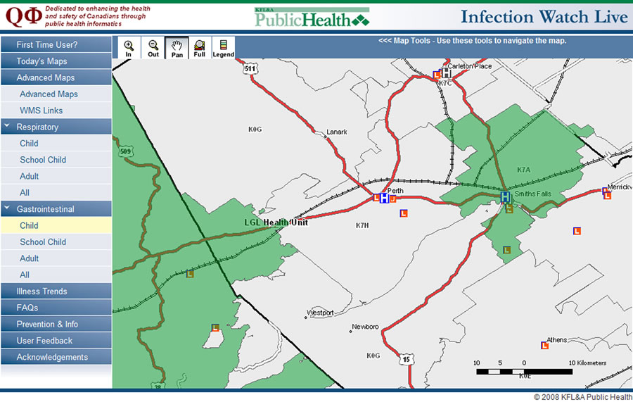 A new Web application, Infection Watch Live, will use geography to inform an Ontario, Canada, community about respiratory and gastrointestinal illnesses reported from nine area hospitals. |
Infection Watch Live will map illnesses, such as bronchitis and the stomach flu, in near real time based on reports from emergency rooms in and around Kingston. The Web application was developed using ESRI's ArcGIS Server technology and is scheduled to become available to the public in February.
The application will generate summary maps of real-time respiratory and gastrointestinal data reported in emergency rooms. Online access to these maps will give health care providers, school officials, and Kingston area residents an at-a-glance picture of where to expect spikes in these illnesses.
Health services groups in Ontario, Canada, are working with GIS consultants to make the information available on a Web site operated by Kingston, Frontenac, Lennox and Addington (KFL&A) Public Health in association with Queen's University Public Health Informatics (QPHI). Visit the site atwww.kflapublichealth.ca.
Read more: http://www.esri.com/news/arcwatch/0109/feature.html
Ingen kommentarer:
Send en kommentar