mandag den 31. august 2009

Let Google Be Your Geo Database


Den dag vil komme hvor det vil være muligt at få interoperability extensionen baseret på Safe Soft FME til at levere data til dine ArcGIS Server SOC processes oppe i Amazon skyen, som til sidst vil kunne vises på Google Map /Bing / eller en hvilken som helst anden Web baseret kort klient ...
/Sik


The day will come when the interoperability extension based on Safe Soft FME will enable your ArcGIS SOC processes running in the Amazon Cloud to produce maps to be viewed on Google Map / Bing / and any other web based client ...
/Sik


Quote

Adam DuVander

When Google announced its Maps Data API it provided programmatic access to the features available in the Google My Maps product (more at our Google Maps API profile). With it, developers can create, organize and update maps. Could it also replace a database for holding geographic points?

Platial, a mapping platform to share stories, thinks so. It was an alpha tester for the API, rewriting its backend to use Google to store its points. The API provides access to lines, shapes and the most common placemarks, which are created by latitude/longitude coordinates. Just as Google’s My Maps is useful for creating maps without JavaScript programming, the Maps Data API can be used for those who don’t want to run their own database.

However, this first version of the Maps Data API can’t perform advanced queries, though many casual mapping users will find the service sufficient for maintaining a simple list of places. Most of Google’s products start simply and become more powerful once the initial concept has been proven. [...]


Read more: http://blog.programmableweb.com/2009/08/31/let-google-be-your-geo-database/

Best Beer in America 2009


Jeg har lige netop sat gær på 20 liter American Brown Ale som skal nydes hen over efteråret ;-)
Se opskrift her
/Sik


I've just added yeast to 20 liters of fine American Brown Ale ... To be enjoyed this fall ;-)

Scents of the City


Da jeg var i New York første gang som en lille knægt (og med lugtesansen i behold) synes jeg at der lugtede rigtigt grimt ... Tænk sig at skulle leve i det hver dag? Senere som voksen har jeg været knap så meget besværet af lugten, men generalt set så lugter en storby bare ikke godt ...
/Sik


When I first visited NY as a little boy (and still having a fine nose capability) I thought it the smell was awfull ... Image having to live with that everyday? Later as a grown up I have not been as troubled with the smell but anyhow the smell of big cities aren't just not good ...
/Sik


Quote

New York secretes its fullest range of smells in the summer; disgusting or enticing, delicate or overpowering, they are liberated by the heat. So one sweltering weekend, I set out to navigate the city by nose. As my nostrils led me from Manhattan’s northernmost end to its southern tip, some prosaic scents recurred (cigarette butts; suntan lotion; fried foods); some were singular and sublime (a delicate trail of flowers mingling with Indian curry around 34th Street); while others proved revoltingly unique (the garbage outside a nail salon). Some smells reminded me of other places, and some will forever remind me of New York.


Read more: http://www.nytimes.com/interactive/2009/08/29/opinion/20090829-smell-map-feature.html?th&emc=th

lørdag den 29. august 2009

How NOT to use PowerPoint!


Powerpoint fik gjort endelig has med over heads ... Men indhold og form er langt hen ad vejen forblevet den samme ... De største fremskridt er sket i forhold til overgange og små standard animationer ... Set og afprøvet så mange gange at man bliver mere træt af det en begejstret for det ... På sitet SlideShare.com ser man dog en enorm kreativitet som løfter os ud af bullet-liste-helvedet - her finder man rigtig mange eksempler på både anderledes, flotte og ganske underholdende præsentationer ... Hovedårsagen til dette tror jeg er at forfattere som lægger materiale på SlideShare tænker mere på hvorledes deres præsentation kan stå alene fremfor hvorledes han eller hun skal bruge den som støtte i en live talk ...
Skal man gå andre veje er der heldigvis også andre alternativer til PP - f.eks. http://prezi.com/ - her kan man fortælle sin historie på et uendeligt stort canvas med mulighed for uendeligt zoom ... Overvej lige hvad det kan give af spændende muligheder ... Skulle man fortsat sværge til PP kan man jo håbe på at PP 2010 kan hæve niveauet over det middelmådige ...
/Sik


PowerPoint got rid of all the annoying over heads ... But the content and the substance more or less stayed the same ... We got added (standard) animations and text popping and flopping ... By now seen so many times and so heavily over done that it's more boring than awakening ...
At SlideShare.com you'll however see an enormous load of creativity moving far away from the bullet-list-hell ... Here you'll find many good examples of fresh new and entertaining presentations ... The main reason I think owed to the fact that the authers create these presentations as stand alones and not as live support safety nets ...
Should you feel like going other directions you'll find several alternatives among those http://prezi.com/ - the idea here is to have an infinite canvas with unlimited zoom capabilities ... Image what that may bring you ... Should you still fell like a PP man you can only hope that the PP 2010 will heighten the level of the mediocre ...
/Sik


Quote


According to Don McMillan, here is a humorous & yet insightful viewpoint on how people (teachers included) should not be using PowerPoint. [...]

Read more: http://www.youtube.com/watch?v=cagxPlVqrtM

Gennemfør DHL Stafetten 2009 uden sved på panden


Søren har gjort det igen. Brug Google Earth til din mental træning af ruten ... Næste år må jeg se at få lavet ruten her i Odense ;-)
/Sik


Mental training is great (for runners and others) and with Google Earth you can visualize the route easily ...
/Sik


Quote

Af Søren Johannesen

[...] Efter den interaktive tur er blevet indlæst i websiden, så klikker du nede i venstre hjørne af kortet på “Afspil” knappen. Du vil nu på 3 min. tage DHL Stafetten rundt i Fælledparkens område ledsaget af musik. [...]

DHL Stafetten 2009 rute


Read more:

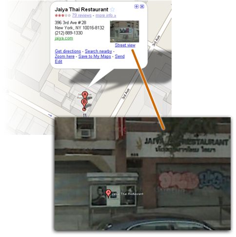
Google Lets You Jump From a Location to Its Street View


Endnu et manglende led til kæden ...
/Sik


Another missing link implemented ...
/Sik


Quote

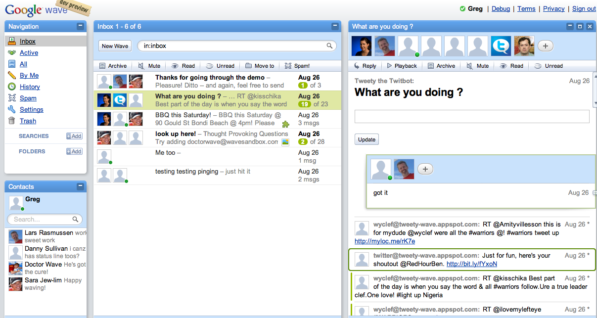
Google Expanding Access To Wave Soon, First “Hands-On” Impressions


En revolution eller et mainstream produkt ...
/Sik


Another revolution on the horizon or just another mainstream flick ...
/Sik


Quote

by Greg Sterling
At the end of next month, September 30, Google will expand the current “developer preview” of Google Wave to roughly 100,000 consumer users. According to Google, “included in this group of early testers will be some of the businesses using Google Apps.” In anticipation of this wider release, Danny and I got some time with Lars Rasmussen and the rest of the Google Wave team the other day. [...]

Danskerne kan ikke udnytte gode digitale services


GIS kunne være et kraftigt værktøj til at lette forståelsen af den IT baserede process. Desværre har GIS sammen med IT generelt formået at forblive det svære faglige område som kun teknikere og nørder med skæve tankesæt finder sig på hjemmebane i ... Og igen så er det jo ikke helt sandt ... Hele Web 2.0 revolutionen og deri også hele den sociale bølge har jo mere en bevist at IT holder og at ALLE kan være med ... Det som man endnu ikke har formået når vi taler offentlig IT og services stillet til rådighed af det offentlige det er at gøre tjenester lige så mundrette som førnævnte. Spørgsmålet er dog om det vil kunne lade sig gøre ... jeg tror det, men jeg har dog ikke Facebook og lignende i tankerne - det er kun det gnidningsløse flow og uendelige antal af muligheder jeg ser for mig ... Det kan lade sig gøre ...
/Sik


Only Danish ...
/Sik


Quote

[...] 66 procent af de 18-45 årige mener, internettet har forbedret det offentliges service. Kun 16 procent af det repræsentative udsnit af befolkningen, der er blevet spurgt, mener ikke, at de digitale kanaler har ført til forbedret service.

Og hvis man zoomer ind på gruppen af 26-35 årige, så foretrækker 60 procent ligefrem kommunikation via mail og hjemmesider frem fra andre former - for eksempel at ringe eller møde op på et servicecenter. [...]


Read more:

fredag den 28. august 2009

Create Customized Maps in the Cloud with Amazon EC2 and Tile Drawer


En skypumpe?
/Sik


A cloud map?
/Sik


Quote

Adam DuVander

Making your own map imagery is now much, much easier. Tile Drawer is an Amazon EC2 (our Amazon EC2 API profile) machine image with all the software needed to create your own map tile server.

Tile Drawer example images

The solution, created by Stamen Design’s Michal Migurski, uses Mapnik (an open source GIS toolkit) and Open Street Map data. Mapnik, especially, is notoriously difficult to get working correctly. With the Amazon image created by Migurski, everything is ready to go. All you need to do is tell it which Open Street Map file and stylesheet to use–and Tile Drawer makes several examples available. [...]


Read more: http://blog.programmableweb.com/2009/08/28/create-customized-maps-in-the-cloud-with-amazon-ec2-and-tile-drawer/

How to create a data report with ArcGIS Diagrammer


Ser umiddelbart ret brugbart ud ...
/Sik


Nifty little tool ...
/Sik


Quote

ArcGIS Diagrammer is productivity tool for ESRI’s ArcGIS Desktop users. Diagrammer is primarily used to create or view geodatabase designs in a graphical editor. This post will examine data reporting, a feature of Diagrammer that might be useful to a wide variety of ArcGIS Desktop users. [...]

The report includes a header table and details about all feature classes, tables and subtypes. Most useful is the number of features/rows per feature class, table and subtype. Lastly, the report includes a small thumbnail representation of the data that, by default, hyperlinks to a larger image.

[...]


Read more:

torsdag den 27. august 2009

Download Over a Million Public Domain Books from Google Books in the Open EPUB Format


Mangler du noget at læse i ...
/Sik


Need something to read ...
/Sik


Quote

Over the years, we've heard a lot from people who've unearthed hidden treasures in Google Books: a crafter who uncovered a forgotten knitting technique, a family historian who discovered her ancestor once traveled the country with a dancing, roller-skating bear. The books they found were out of copyright and in the public domain, which meant they could read the full text and even download a PDF version of the book.

I'm excited to announce that starting today, Google Books will offer free downloads of these and more than one million more public domain books in an additional format, EPUB. By adding support for EPUB downloads, we're hoping to make these books more accessible by helping people around the world to find and read them in more places. More people are turning to new reading devices to access digital books, and many such phones, netbooks, and e-ink readers have smaller screens that don't readily render image-based PDF versions of the books we've scanned. EPUB is a lightweight text-based digital book format that allows the text to automatically conform (or "reflow") to these smaller screens. And because EPUB is a free, open standard supported by a growing ecosystem of digital reading devices, works you download from Google Books as EPUBs won't be tied to or locked into a particular device. We'll also continue to make available these books in the popular PDF format so you can see images of the pages just as they appear in the printed book.

To get started, just find any public domain book on Google Books and click on the Download button in the toolbar.


Of course, these public domain books weren't born in EPUB format--or even in digital format at all. Let's say you download a free EPUB copy of Treasure Island. You're taking a final step in a long process that takes a physical copy of Robert Louis Stevenson's book and transforms it into something you can download for your iPhone. The process begins with a book that has been preserved by one of our library partners from around the world. Google borrows the book from one of our library partners, much like you can from your local library. Before returning the book in undamaged form, we take photographs of the pages. Those images are then stitched together and processed in order to create a digital version of the classic book. This includes the difficult task of performing Optical Character Recognition on the page image in order to extract a text layer we can transform into HTML, or other text-based file formats like EPUB (if you're interested, you can read more about this process here).

Digitizing books allows us to provide more access to great literature for a wider set of the world's population. Before physical books were invented, thoughts were constrained by both space and time. It was difficult for humans to share their thoughts and feelings with a set of people too far from their physical location. Printed books changed that by allowing authors to record their experiences in a medium that could be shipped around the world. Similarly, the words written down could be preserved through time. The result was an explosion in collaboration and creativity. Via printed books, a 17th century physicist in Great Britain could build on the work of a 16th century Italian scholar.

Of course, it can be difficult and costly to reproduce and transport the information that older physical books contain. Some can't afford these works. Others who might be able to afford to purchase them can't unless they can find a physical copy available for sale or loan. Some important books are so limited in quantity that one must fly around the world to find a copy. Access to other works is only available to those who attend certain universities or belong to certain organizations.

Once we convert atoms from physical books into digital bits, we can begin to change some of that. While atoms remain fairly expensive, digital bits are on a trend where they become ever cheaper to produce, transport, and store. For example, providing every student in a school district with a paper copy of Shakespeare's Hamlet might cost thousands of dollars. Yet if those same students already have cell phones, laptops, or access to the Internet, then they can access a digital copy of Hamlet for just a fraction of the cost. Often times, public domain texts in digital form are more affordable and accessible to the public than their physical parents.

All of this of course assumes that a digital version of the book exists. I love going into work each morning knowing that we're working to convert atoms into bits and that by doing so, we hope to make knowledge more accessible. In a world where educational opportunities are often disproportionately allocated, it's exciting to think that today anyone with an Internet connection can download any of over one million free public domain books from Google Books. Who knows. Maybe some kid will read Treasure Island on their phone and be inspired to write their own great novel some day.

Read more: http://booksearch.blogspot.com/2009/08/download-over-million-public-domain.html

onsdag den 26. august 2009

ArcGIS Sever In The Cloud Gets A Little Closer


Smid SOC'erne op i skyen ... men ikke for langt væk ...
/Sik


Put the SOCs into the cloud ... but not too far ...
/Sik


Quote

[...] Giving it a quick read, it looks like you'll be able to add an Amazon Cloud based server to your existing network, via a standard VPN connection. [...]

The first thing that came to my mind was spinning up ArcSOC servers to handle additional load if your main box (on your own physical network) gets swamped. Just add a new SOC server (an EC2 instance) to your existing ArcGIS Server. I have no idea if the network latency would be an issue in a distributed environment like this, but I suspect it will be. [...]


Amazon VPC Functionality

Amazon VPC enables you to use your own isolated resources within the AWS cloud, and then connect those resources directly to your own datacenter using industry-standard encrypted IPsec VPN connections. With AmazonVPC, you can:

  • Create a Virtual Private Cloud on AWS’s scalable infrastructure, and specify its private IP address range from any block you choose.
  • Divide your VPC’s private IP address range into one or more subnets in a manner convenient for managing applications and services you run in your VPC.
  • Bridge together your VPC and your IT infrastructure via an encrypted VPN connection.
  • Add AWS resources, such as Amazon EC2 instances, to your VPC.
  • Route traffic between your VPC and the Internet over the VPN connection so that it can be examined by your existing security and networking assets before heading to the public Internet.
  • Extend your existing security and management policies within your IT infrastructure to your VPC as if they were running within your infrastructure.

Read more:

Metro Paris Subway iPhone and iPod Touch Application


Udvid din verden ... i Paris ...
/Sik


Augment reality ... in Paris ...
/Sik


Quote

Metro Paris Subway

- Metro Paris Subway Your New Eye. This new update features a unique augmented reality functionality (only available to Apple iPhone 3GS users) that enables you to see the nearest stations and POI! Elements located at a distance less than 1km (0,621miles) only will be displayed.

Métro Paris

Gaia 3.4 Release Provides Powerful Platform for SDI Users and Developers


En af de bedste gratis all round map viewers ...
/Sik


One of the best all round map viewers ...
/Sik


Quote

The Carbon Project today announced the release of Gaia 3.4, a powerful free platform designed to support Spatial Data Infrastructure (SDI) users and developers. The Gaia 3.4 platform release includes new SDI tools, an open API for software developers and support for OGC data and services, ESRI ArcGIS Server, Bing Maps and OpenStreetMap.

You can visit www.thecarbonproject.com/gaia.php to download the free Gaia 3.4 today. A suite of free Extenders and API documentation are also available. Technical information and forums for the Gaia 3.4 platform and its Extenders are available atwww.TheCarbonPortal.net.

"Gaia 3.4 is a geospatial network platform that provides seamless synergy between Microsoft Bing Maps, Yahoo! Maps, OpenStreetMap, ESRI ArcGIS Server, Open Geospatial Consortium (OGC) KML, GML, GMLsf, WMS, WMTS, WFS, Filters, WCS, ESRI Shape, Autodesk and MapInfo formats, and more," said Jeff Harrison, President and CEO of The Carbon Project. "Gaia 3.4 is part of our commitment to help SDI users and developers meet tomorrow's infrastructure, transportation, environmental and national security challenges."

"The Gaia 3.4 platform is built with the latest CarbonTools PRO assemblies and complete source code is available to CarbonTools PRO developers. Gaia 3.4 also provides a robust, open API that allows any programmer to develop Gaia Extenders with or without a CarbonTools PRO license. Gaia Extenders are light, easy to deploy and can enhance Gaia's functionality for simple and complex GIS and SDI tasks," said Nuke Goldstein, CTO of The Carbon Project.

Initial Gaia development was sponsored by the National Spatial Data Infrastructure (NSDI) Cooperative Agreements Program (CAP).

For more information please contact info@TheCarbonProject.com today.

About The Carbon Project

The Carbon Project is an innovative, high-energy software and technology company specializing in spatial data infrastructure applications and innovative geosocial solutions. The Carbon Project serves professionals, software developers, government agencies and businesses that develop mapping solutions or use geospatial data. Headquartered in Burlington, MA with offices in Virginia, The Carbon Project is a privately owned company backed by individual investors. For more information please visit:www.TheCarbonProject.com.


Read more: http://www.thecarbonproject.com/news_gaia3.4.php

Bing Maps WMS beta service, powered by OnTerra


Bing maps som WMS ... Hvordan i alverden ...
/Sik


Bing Maps as WMS ... What's the catch ...
/Sik


Quote

This is a beta service is provided by the experts at OnTerra Systems, for evaluation and testing only. It allows you to access Bing Maps base data such as ortho imagery, road data and hybrid layers (road + ortho) in Open Geospatial Consortium (OCG) - Web Mapping Service (WMS) format. This service works in conjunction with any WMS capable application. Currently this beta service supports WMS 1.3.0 and 1.1.1 standards, and primarily using web Mercator projection. We are working to make sure we can correctly support the majority of WMS enabled applications. If you have any feedback or issues email bingmapswms@onterrasys.com. [...]


Arterial traffic available on Google Maps


Vi er alle potentielle sensorer ...
/Sik


We are all potential sensors ...
/Sik


Quote

Commuters have long relied on traffic sites to help them determine their last-minute path around poor traffic on the highway. But if the traffic looks bad on the highways, you'll probably want to know how it looks on the alternate routes through arterials. I usually would just guess that the traffic on back roads is light, but with this new launch the guesswork is eliminated: Google Maps will now show you live traffic conditions on arterial roads in selected cities. Just zoom-in on the city you're interested in, and click the "Traffic" button in the upper-right corner of the map. As you zoom in closer to an area of interest, we'll color the arterial roads, in addition to the highways, to show current traffic conditions. Just as with the highways, the colors correspond to the speed of traffic (relative to the speed limit of the road): green is free sailing, yellow is medium congestion, red is heavy congestion, and red/black is stop-and-go traffic.

For example, here's how traffic looks near the Google Seattle office today.

Here are some examples of what you can find out with this new feature:

Highways aren't looking great. Probably time to take the scenic route!

Trying to get to the airport on time? Now you can see the traffic on many of the roads leading there so you know the best route to take so you won't miss your flight:


If you have Google Maps for Mobile, you can see the same traffic there and, better yet, help improve the data: See our post on the Official Google Blog about traffic crowdsourcing. Here's to a happier commute!

Read more: http://google-latlong.blogspot.com/2009/08/arterial-traffic-available-on-google.html

3 Days, 3 Googlers, 2 CPUs, 8 Cores: Google goes to Camp Roberts


Skulle man ikke invitere dem med til Udfordringen ved Kortdage 2009?
/Sik


Wish I had this sort of 'muscles' available ...
/Sik


Quote

Recently, three Googlers visited Camp Roberts near Paso Robles in central California. The exercise, organized and hosted by the Naval Postgraduate School, brought tech companies together with testers to collaborate on disaster relief, humanitarian aid, and development.

Shortly after we arrived, we disrupted the relative quiet of the Tactical Operations Center (TOC) by spooling up an 8-core Google Earth Enterprise Server to process satellite imagery provided by the National Geospatial-Intelligence Agency (NGA). We used the server to process the imagery – 1m resolution GeoEye IKONOS scenes over Jalalabad, Afghanistan – with Google Earth Fusion to create a 3D globe and set of Mercator map tiles. We then published the tiles to the Portable Earth Server running in an Ubuntu Virtual Machine to be used as a base imagery layer for mashups by other applications including Sahana, Development Seed,FortiusOne, Open Street Map, and InSTEDD.


Once we provided the new imagery tiles, other applications could pull the imagery into Disaster Management systems, and, combined with their value-added utilities, continually update their geo-information, which positioned them to respond more quickly to the next disaster.

Later in the afternoon, volunteers from the Open Street Map Foundation, Umbrella Consulting, and Stamen Design utilized the imagery tiles and Open Street Map vector overlays to print hard-copy "Walking Papers." These Walking Papers were sent into the field where road and structure information was noted by hand. Back at the TOC, the annotated maps were scanned. Because a QR code on the maps contained coordinate information, annotations were automatically georeferenced as the data was imported into the Open Street Map database. This paper-and-pen method was a smart, practical, low-tech way to to increase the accuracy and data density of vector data for an area of interest.

We saw first-hand the range of challenges technologists face as they look to balance ever-changing information with tools designed for a highly connected world, and as they work in less-than-ideal states of connectivity out in the field. Some problems were successfully dispatched in 20 minutes; others remained unsolved after 3 days.

This week at Camp Roberts reaffirmed the powerful role that agile deployments of geospatial visualization and analysis can play in the quest to build sustainable political structures and mitigate human suffering. We learned to adapt and respond to mixed states of connectivity, and wide ranges of technological states and proficiencies amongst end users. We are going to keep working on projects that aid in the mitigation, recovery and building processes. And we're going to keep supporting open source applications and data projects that address these challenges–and are flexible enough to meet them.


Read more: http://google-latlong.blogspot.com/2009/08/3-days-3-googlers-2-cpus-8-cores-google.html

The Open Group Cloud Work Group


Cloud Computing vil ende i hegnet hvis ikke der kommer standarder på bordet ... I værste fald vil vi komme til at se en række skyformationer ...
/Sik


Cloud Computing won't succeed unless standards gets agreed upon ... In worst case scenario we will see different Clouds formations in the horizon ...
/Sik


Quote

The Open Group Cloud Work Group exists to create a common understanding among buyers and suppliers of how enterprises of all sizes and scales of operation can include Cloud Computing technology in a safe and secure way in their architectures to realize its significant cost, scalability and agility benefits. It includes some of the industry’s leading cloud providers and end-user organizations, collaborating on standard models and frameworks aimed at eliminating vendor lock-in for enterprises looking to benefit from cloud products and services.

We are committed to work with other groups with similar aims. At the outset, it is our intent to work with:
We are open to working with other relevant organizations.

The direction of the group is determined by Open Group members, but you don't have to be a member to participate - everyone interested in cloud computing can join in the discussions. [...]


Read more: http://www.opengroup.org/cloudcomputing/

Mobile map projector with GPS lights the way


De første mobiltelefoner med projektor er også på trapperne ...
/Sik


Mobile phones with projector beams are coming too ...
/Sik


Quote


This handy portable map projector equipped with GPS makes getting lost a thing of the past. All you need is a surface to shine your map on. A friend's forehead would do. [...]

Read more: http://news.cnet.com/8301-17938_105-10316753-1.html