
Det kræver at du opretter dig som bruger og så er det ellers der ud ad ... Download en plugin (hav tålmodighed 10-15 minutter) og så sker det ... Dog ikke hvis du anvender Chrome ... Men så kan du f.eks. tilføje lokale shape filer ...
/Sik

You gotta create an account but after that you are free to go ... Download a plugin (takes a while - be patient, 10 - 15 minutes) and then you are off ... Unless you use Chrome then you're stuck ... If not stuck you may be able to add your own shape files ...
/Sik
Quote

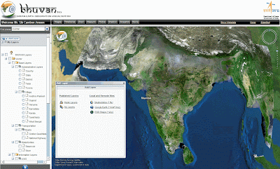
Basic features of Bhuvan:
- Access, explore and visualise 2D and 3D image data along with rich thematic information on Soil, wasteland, water resources etc.
- Visualise multi-resolution, multi-sensor, multi-temporal image data
- Superpose administrative boundaries of choice on images as required
- Visualisation of AWS ( Automatic Weather Stations) data/information in a graphic view and use tabular weather data of user choice
- Fly to locations ( Flies from the current location directly to the selected location)
- Heads-Up Display ( HUD) naviation controls ( Tilt slider, north indicator, opacity, compass ring, zoom slider)
- Navigation using the 3D view Pop-up menu (Fly-in, Fly out, jump in, jump around, view point)
- 3D Fly through (3D view to fly to locations, objects in the terrain, and navigate freely using the mouse or keyboard)
- Drawing 2D objects (Text labels, polylines, polygons, rectangles, 2D arrows, circles, ellipse)
- Drawing 3D Objects (placing of expressive 3D models, 3D polygons, boxes)
- Snapshot creation (copies the 3D view to a floating window and allows to save to a external file)
- Measurement tools (Horizontal distance, aerial distance, vertical distance, measure area)
- Shadow Analysis (it sets the sun position based on the given time creating shadows and effects the lighting on the terrain)
- There would be many more value added functions and facilities which will be added into the package from time to time.
- Particular interest of ISRO/DOS would be to provide such functionalities to common man so that he/she adopts participatory approach with scientists to solve simple problems easily and interactively.
Advanced functionalities to be provided in future versions
- Urban Design Tools (to build roads, junctions and traffic lights in an urban setting)
- Contour map ( Displays a colorized terrain map and contour lines)
- Terrain profile ( Displays the terrain elevation profile along a path)
- Draw tools (Creates simples markers, free hand lines, urban designs)
- Navigation map (to jump to and view locations in the 3D India)
Read more: http://bhuvan.nrsc.gov.in/
Ingen kommentarer:
Send en kommentar