
GIS som kan bruges til noget ... et bevis på at det kan lade sig gøre at skabe en værdifuld og brugbar løsning på meget kort tid ... Når blot viljen er der ...
/Sik

GIS showing what it's here for ... a proof that you can make valuable and useful solutions in a very short time ... If the determination is there ...
/Sik
Quote
By Deborah Davis , IDV Solutions
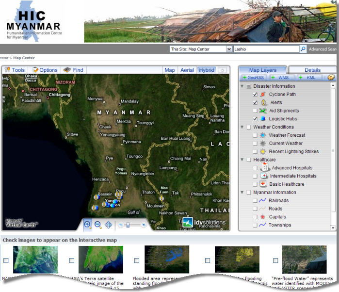
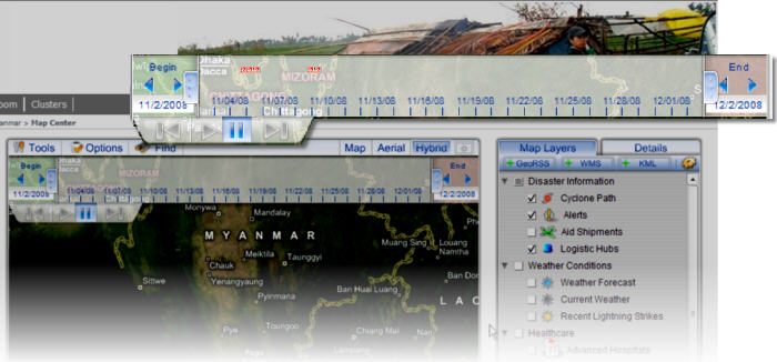
When Cyclone Nargis hit the Southeast Asian country of Myanmar in May 2008, governments and international relief agencies were faced with a humanitarian emergency that required swift action. Because of the size and complexity of the emergency, the United Nations deployed a Humanitarian Information Center (HIC) website to coordinate relief efforts. To effectively share information on weather, travel, flooding and available health care resources the site included an interactive Map Center, created in a single week using Visual Fusion by IDV Solutions.
Visual Fusion provides a platform for managing many types of geospatial content and for creating applications that display enterprise data and Web feeds on a Virtual Earth map. For the Myanmar HIC, it solved the problem of uniting data in diverse formats from many sources, including:
- NASA satellite images of Myanmar
- weather forecasts and rainfall data from commercial forecasting services
- information on the country's transportation network, from the United Nations Joint Logistics Centre (UNJLC)
- maps indicating flooded areas from the UN Operational Satellite Applications Programme
- locations of logistical hubs
- security alerts
- locations of hospitals and other health care providers
- information on incoming aid shipments
Read more: http://www.directionsmag.com/article.php?article_id=2989&trv=1
Ingen kommentarer:
Send en kommentar