
GeoNames ... faldt over et bjerg af stednavne og tilhørende data. Det er frit at downloade, integrere med via web services eller blot søge / browse rundt i ... En guldgrube!
/Sik
PS. Søren har du set / hørt om sitet før? Var det ikke noget at koble sammen med din GaiaProjector?

GeoNames ... accidently stumbled over this mountain of place names and associated data. It's free for download, for integration via web services, or just for search and browsing ... Great!
/Sik
Quote
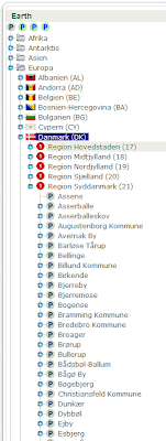
GeoNames ... accidently stumbled over this mountain of place names and associated data. It's free for download, for integration via web services, or just for search and browsing ... Great!
/Sik
Quote
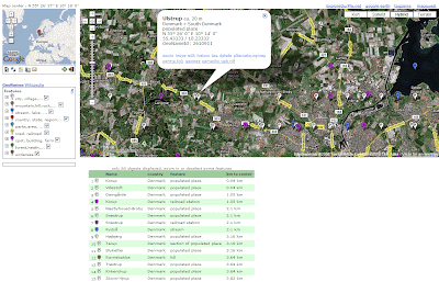
The GeoNames geographical database is available for download free of charge under a creative commons attribution license. It contains over eight million geographical names and consists of 6.5 million unique features whereof 2.2 million populated places and 1.8 million alternate names. All features are categorized into one out of nine feature classes and further subcategorized into one out of 645 feature codes. (more statistics ...).
The data is accessible free of charge through a number of webservices and a daily database export. GeoNames is already serving up to over 11 million web service requests per day.
Postal codes are available as a separate download.
The data is accessible free of charge through a number of webservices and a daily database export. GeoNames is already serving up to over 11 million web service requests per day.
GeoNames is integrating geographical data such as names of places in various languages, elevation, population and others from various sources. All lat/long coordinates are in WGS84 (World Geodetic System 1984). Users may manually edit, correct and add new names using a user friendly wiki interface.
GeoNames has Ambassadors in many countries who assist with their help and expertise. Meet the GeoNames Team.
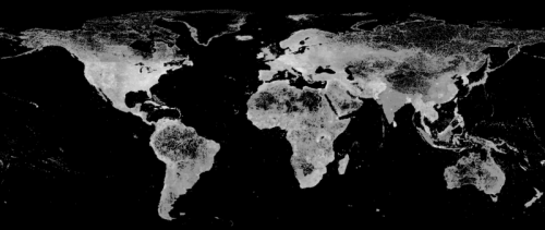
Figure : GeoNames Feature Density Map
Data Dump
A daily GeoNames database dump can be downloaded in the form of a large worldwide text file (allCountries.zip). Additional country files are available for convenience. You find the files on our download server. Read the readme.txt for details.Postal codes are available as a separate download.
jeg har hørt om Geonames - men foretrækker på nuværdende tidspunkt at benytte Googles egen geocoder som søgemaskine feltet. Jeg arbejder på at lave en ny download version af Gaiaprojector -så dem der lyster kan få en kopi og benytte deres egne KML filer. Desværre er KML i DK ikke så udbredt endnu - så det er begrænset hvor mange der kan have en interesse i dette.
SvarSletNice info. on Data Dump... thanks...
SvarSlet