
Det ender med at alle servere kan levere KML og alle klienter kan læse KML ... En dag opbevares data også som KML ...
/Sik

Soon all servers kan deliver KML and all clients can read KML ... One day data is also stored as KML ...
/Sik
Quote
KMLMapServer turns your UMN MapServer installation in a flexible KML vector and raster data server. Dynamically serve your MapServer data straight into Google Earth.
The layer server
KMLMapServer was designed with OGC webservices in mind, when possible, the parameter names and meaning are the same as in WFS OGC service, and you normally call KMLMapServer with CGI-style parameters passed on the URL.
A typical call would be:
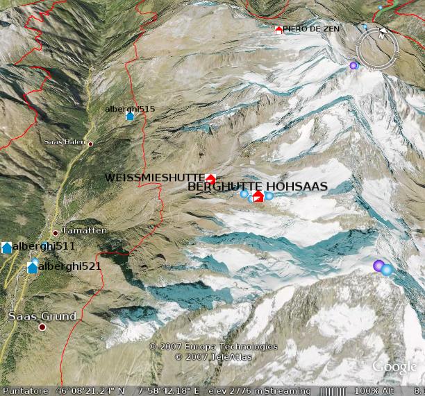
http://www.myserver.com/kmlservice.php?map=/maps/mapfile.map&typename=roads,rivers
In this example the layers “roads” and “rivers” from mapfile /maps/mapfile.map are sent to the browser.
Note that you don’t need to specify the layer name(s), you can also get a KML with all the layers in the mapfile, in this case the layers will be served as a folder of Network Links.
The icon server
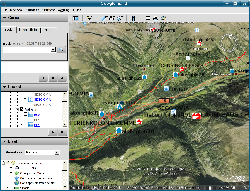
The icon server is an independent package that creates PNG images of the symbols used for point layers.
It is called through the same endpoint of the main service, the request type is “icon”.
See the image for some example symbols how they appear in the table of contents (click to enlarge).
Features
- KML and KMZ (compressed) output
- Simple cache system to reduce server load with big vector data layers
- Independent symbol server for POINT layers icons
- Customizable Balloons (tooltips) in Google Earth with attribute substitution template
- Limited support to MapServer’s classes and styles for thematic mapping
- Limited support to ogc filter encoding for single vector layer requests
- Raster support through WMS network links
To take fully advantage of some of these feature, additional configuration could be required.
Read more: http://www.itopen.it/soluzioni/kml-map-server/
Ingen kommentarer:
Send en kommentar