
Columbus gå hjem ...
/Sik

Did Columbus know of the Vinland map?
/Sik
Quote
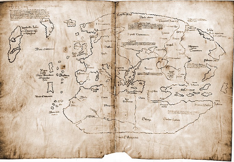
The Vinland map is purportedly a 15th-century mappa mundi, redrawn from a 13th-century original. In addition to showing Africa, Asia and Europe, the map depicts a large island west of Greenland in the Atlantic labelled as Vinland; the map describes this region as having been visited in the 11th century. If authentic, such evidence is an important addition to archaeological findings such as the L'Anse aux Meadows Norse site in Newfoundland, documenting pre-Columbian Norse travels to the Americas, but the map has been controversial since it was first revealed in 1965. Chemical analysis (2002[1]), meta-analysis of the accumulated scientific data (2008[2]) and scholarly monograph on the subject (2004[3]) have all suggested that it is a forgery. However, claims of authenticity have been made at a 2009 conference.[4]
Ingen kommentarer:
Send en kommentar