
Hold dig orienteret ...
/Sik

Stay informed ... live from SD ...
/Sik
Quote
Live blogging – all times PST and I’ll try to get pictures up as quick as possible.
8:39 – Meet the people around you. I met a nice guy from the ESRI surfaces office out of Denver named Jonathan. He’s involed in the aerospace group out of that office
8:40 – Jack’s running down the wealth of work that everyone out in the field actually do. No shock – nearly every field is touched by GIS.
8:42 – SAG Award winners stand up. I always like to look for those badges and give them the two finger “howdy” salute bikers give each other on the highway. Not sure anyone else gets that. But it amuses me.
8:43 – Centpoint energy gets a SAG award. Short video showing what they do. No surprise energy is winner, as they’re a huge GIS user. They’re heavily in the enterprise stuff. Right now, they’re demoing how storm and hurricane predictions help they figure out where to put their repair resources. It’s pretty cool. Thousands of crews together ready to deploy. Cindy is accepting the award for the company. Jack is saying that in several hurricans, Cindy mobilized all their people to restore power in days.
8:47 – Making a difference award. Being given to an Indian scientist Dr. Kasturirangan, who is the godfather of the India remote sensing space organization. He has apparently run for office in the Indian government, and is now going to run the national planning in that country.
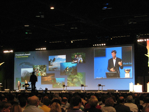
8:50 – President’s Award. Jack’s favorite (no surprise there). This year goes to the state of Maryland, one of ESRI’s first customers. They’ve been doing some interesting things with server. I know West Virginia has adopted some of the technology and techniques they’ve developed. Jack says this is largely to result of the vision of the Governor O’Malley. The Governor is saying that GIS isn’t just a tool or a techniques, it allows connections to be made between groups and ideas. Side note – the green tie is kinda cool. Not many politicians rock the bright green tie, so kudos. He’s bringing up some of their government people actually doing the work. He’s asking why every citizen’s first question is always – “Can you show me my house?” Good question. Then half of them will freak out because you CAN show them your house. Just my own experience, not the good Governor’s. He’s detailing how they’re using “smart maps”. Oddly enough, probably the most popular is using them to reduce wait times at the DMV. Is there any government agency more hated than the DMV? Green print sounds cool. It shows the environment of anyone who wants to put in their address and how it can be protected. Now he’s talking about the recovery act. Maryland has developed a really cool site to track how and where that money from the federal government is being spent. West Virginia has adopted the same system. It’s built on ArcServer and the Flex API (which is pretty fun in my experience).
8:50 – President’s Award. Jack’s favorite (no surprise there). This year goes to the state of Maryland, one of ESRI’s first customers. They’ve been doing some interesting things with server. I know West Virginia has adopted some of the technology and techniques they’ve developed. Jack says this is largely to result of the vision of the Governor O’Malley. The Governor is saying that GIS isn’t just a tool or a techniques, it allows connections to be made between groups and ideas. Side note – the green tie is kinda cool. Not many politicians rock the bright green tie, so kudos. He’s bringing up some of their government people actually doing the work. He’s asking why every citizen’s first question is always – “Can you show me my house?” Good question. Then half of them will freak out because you CAN show them your house. Just my own experience, not the good Governor’s. He’s detailing how they’re using “smart maps”. Oddly enough, probably the most popular is using them to reduce wait times at the DMV. Is there any government agency more hated than the DMV? Green print sounds cool. It shows the environment of anyone who wants to put in their address and how it can be protected. Now he’s talking about the recovery act. Maryland has developed a really cool site to track how and where that money from the federal government is being spent. West Virginia has adopted the same system. It’s built on ArcServer and the Flex API (which is pretty fun in my experience).
9:04 – Governor still talking. Intertubes got a small hiccup. Hope I can upload the live blog. Oh no Mr. Bill! Whole presentation just went down. Lovely blue screens abound. Ok, they got it back. That got a round of applause. Is there any more stressful thing for an IT person than a live blow up?
9:08 – Back to the governor’s “can you show me my house?” question. The posits that it might be that people know the government knows about them. Or it might be about the desire to know you belong to a greater connection of the outside world. I think there’s some truth to that, but mostly I think it’s because that’s the geography they know best. We just like to see what we know, because most people don’t understand what they’re seeing with GIS right off the bat. Just my two
9:10 – Jack is back on. He’s saying that Jack and the Governor have down three demos of technology together, and every time the demo has blown up. So don’t buy any lottery tickets with the governor of Maryland and Jack standing in line behind you! Video of people talking is still broken. I bet there are some guys up front freaking out right now.
9:12 – Video’s back. Internet’s not. Now onto ESRI’s “Designing our Future” idea. Jack says they fall into 3 main areas, software, systems, and geography. Everyone is a designer. GIS does design naturally, according to Jack. Thus Jack calls this GeoDesign. He talking about the impact of human existence on the planet. Our landscape is suffering due to the unchecked, unguided and uncoordinated human activities. Ut oh! His slides went out. He’s gotta turn around to the screen. Gets a good laugh. [...]
Read more: http://veryspatial.com/2009/07/13/esri-live-blogging-of-plenary/
Ingen kommentarer:
Send en kommentar