
Tænk at kunne se billeder fra Mars som er nyere end dem du ser fra jorden ...
/Sik

Image that you can see images from Mars that are more recent than those you see of the Earth ...
/Sik
Quote
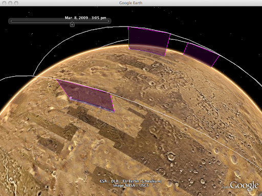 | Live from Mars: NASA's typical release process for Mars satellite imagery requires months, and involves numerous stages of calibration. But thanks to the THEMIS camera teamat Arizona State University, you could turn on the new 'Live from Mars' layer and become one of the very first people to lay eyes on images taken just days or even hours ago! This feature represents the first public continuous stream of fresh high-resolution satellite imagery in the solar system, and can display new images from the THEMIS camera just hours after NASA receives them. You can also see live satellite orbital tracks, or check out where the HiRISE camera plans to image next. |
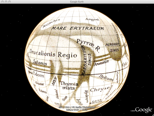 | Historical Maps: In the late 1800s, Giovanni Schiaparellicreated many of the earliest detailed maps of Mars. He famously saw, recorded, and named numerous linear features on the surface, some of which he termed cannali (Italian forchannel). His contemporary, Percival Lowell, re-imagined and misunderstood these features to be artificial canals, sparking a media frenzy back on Earth and captivating the public with the idea of abundant water and an alien civilization on Mars. The Historical Globes layer lets you see these and other antique maps of Mars as virtual spinning globes. |
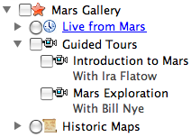 | Guided Tours: If you're not sure where to go on Mars, let Bill Nye the Science Guy and Ira Flatow of Public Radio'sScience Friday show you around. Simply go to the Mars Gallery layer, and double-click either of their tours for a narrated trip around the Martian surface. This is a great way to introduce yourself to some of the most interesting spots on the planet - just sit back, and enjoy the ride. If something catches your eye, you can pause these tours at any time and explore on your own, then hit play to resume your journey. These tours were created with the new Touring feature in Google Earth 5.0. |
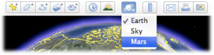
To enter Mars in Google Earth, click the planets button in the main toolbar and select 'Mars':
We hope you enjoy these latest additions. They're made possible by Google's Space Act Agreement with NASA, which enabled NASA Ames researchers to develop much of this content. You can visit earth.google.com/mars to learn more about Mars in Google Earth.
Read more: http://google-latlong.blogspot.com/2009/03/live-from-mars.html
Ingen kommentarer:
Send en kommentar