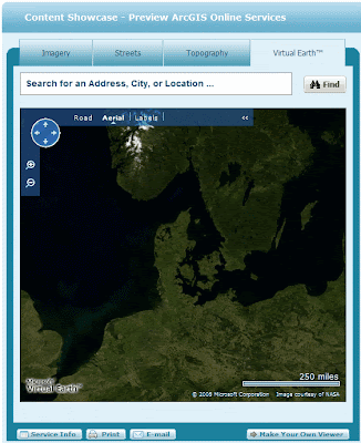
ESRI and Microsoft in close cooporation comes in handy a few dasy before UC 2008.
/Sik

Microsoft Virtual Earth to Be Offered With ESRI’s ArcGIS Online Services
REDMOND, Wash., and REDLANDS, Calif. — July 29, 2008 — Microsoft Corp. and ESRI today announced that ESRI ArcGIS users will have access to the robust mapping and imagery content provided by the Microsoft Virtual Earth platform inside ArcGIS Desktop and ArcGIS Server. With Virtual Earth seamlessly integrated into ArcGIS 9.3 Desktop, ArcGIS users are now able to easily add base maps, which feature rich aerial and hybrid views, to perform data creation, editing, analysis, authoring and map publishing with one-click access.
“Microsoft and ESRI have a long-standing history of delivering complete geographic information systems solutions,” said Erik Jorgenson, corporate vice president at Microsoft Corp. “The integration of Virtual Earth and ArcGIS 9.3 at both desktop application and platform levels enables customers to better view, analyze, understand, interpret and visualize geographic data. This new offering further extends the software-plus-services choices available to our mutual customers.”
“With the new ArcGIS Online Virtual Earth map services, ArcGIS Desktop and ArcGIS Explorer users will have nearly instant access to some of the world’s finest base map layers,” said S.J. Camarata, Director of Corporate Strategies at ESRI. “Through this collaboration with Microsoft, street maps, vertical imagery and hybrid maps will be available on an affordable, annual subscription fee basis.”
Together, Virtual Earth and ArcGIS Online services will enable customers to access resources that add comprehensive depth to their projects. The seamless integration of Virtual Earth throughout the entire ArcGIS system makes it easier for ArcGIS customers to offer their end users better insight into their services, which can inspire deeper involvement and participation with their valuable GIS data.
The ArcGIS Online Virtual Earth map services will include high-resolution street maps, imagery and hybrid maps. Street map coverage is available for more than 60 countries and regions including North America, Europe, South America, the Asia Pacific region and Northern Africa. Aerial and satellite imagery includes worldwide coverage but varies by region. ESRI integrates with other Microsoft products that may be part of a user’s Virtual Earth solution to incorporate internal and third-party data—making information more discoverable, more visual, and better to take action upon.
Land planning, site selection, crime analysis, road network analysis and delivery network management are just a few examples of how ArcGIS desktop users, including ArcGIS Explorer users, can leverage ArcGIS Online Virtual Earth map services. ArcGIS Server users will be able to connect to ArcGIS Online Virtual Earth Map Services at a later date, through a service pack.
Users can preview Virtual Earth street maps, imagery and hybrid map layers at http://resources.esri.com/arcgisonlineservices. To learn more about ArcGIS Online, visit www.esri.com/arcgisonline.
Source: http://www.microsoft.com/presspass/press/2008/jul08/07-29ESRIPR.mspx?rss_fdn=Press%20Releases
Ingen kommentarer:
Send en kommentar